Showing posts with label Earthquakes. Show all posts

Thursday, October 8, 2020

LOAD BEARING MASONRY CONSTRUCTION - Load bearing masonry construction was the most widely used form of construction for large buildings from the 1700s to the mid-1900s. It is very rarely used today for large buildings, but smaller residential-scale structures are being built. It essentially consists of thick, heavy masonry walls of brick or stone that support the entire structure, including the horizontal floor slabs, which could be made of reinforced concrete, wood, or steel members. Most construction today is not load-bearing masonry but frame structures of light but strong materials, that support floor slabs and have very thin and light internal and external walls. The key idea with this construction is that every wall acts as a load carrying element. In a load bearing structure, you cannot punch holes in a wall to connect two rooms - you would damage the structure if you did so. The immense weight of the walls actually helps to hold the building together and stabilise it against external forces such as wind and earthquake. The floor slabs were made of horizontal wooden beams, joists, and planks. A joist is a smaller wooden beam that rests on two larger beams. The buildings were covered with sloping wooden roofs, that could be finished with clay tile, wood or stone shingles, or metal plating such as thin sheets of copper. Every wall had a simple continuous strip foundation below it. Most classic buildings in Europe are built with load bearing masonry construction.

...................................................................................................................................................

Load Bearing Masonry Construction

understandconstruction.com


A modern example of load bearing masonry construction
for a residential building. Note the absence of concrete columns
and beams. The walls are the main load carrying elements.

Load bearing masonry construction was the most widely used form of construction for large buildings from the 1700s to the mid-1900s.

It is very rarely used today for large buildings, but smaller residential-scale structures are being built.

It essentially consists of thick, heavy masonry walls of brick or stone that support the entire structure, including the horizontal floor slabs, which could be made of reinforced concrete, wood, or steel members.

In contrast, most construction today is not load-bearing masonry but frame structures of light but strong materials, that support floor slabs and have very thin and light internal and external walls.

The key idea with this construction is that every wall acts as a load carrying element.

In a load bearing structure, you cannot punch holes in a wall to connect two rooms - you would damage the structure if you did so.

The immense weight of the walls actually helps to hold the building together and stabilise it against external forces such as wind and earthquake.

In traditional European loadbearing masonry structures, the floor slabs were made of horizontal wooden beams, joists, and planks.

A joist is a smaller wooden beam that rests on two larger beams.

The buildings were covered with sloping wooden roofs, that could be finished with clay tile, wood or stone shingles, or metal plating such as thin sheets of copper.

Other such buildings had flat terraces, that were built by pouring a concrete layer over a wooden floor, and then finishing with some form of tile or stone to provide a strong, waterproof finish.

Every wall had a simple continuous strip foundation below it.

Most classic buildings in Europe are built with load bearing masonry construction.

The American architect Louis Kahn famously used load bearing construction for the Indian Institute of Management, Ahmedabad.

His structures clearly express the construction system rather than conceal it under decorative skins.

In this structure, concrete is used exclusively for members in tension, which are ties that tie together the two ends of the brick arches.

WHY IS LOAD BEARING WALL CONSTRUCTION NOT USED TODAY?

IIM Ahmedabad, India, by architect Louis Kahn

Load bearing masonry construction is not used today for a number of reasons:

It does not perform very well in earthquakes.

Most deaths in earthquakes around the world have occurred in load bearing masonry buildings.

Earthquakes love heavy buildings, because that is where they can wreak the greatest havoc.

It is extremely labor-intensive, as it is built mainly of masonry, which is made by hand.

Humans have still not developed a machine that produces masonry!

This also makes for very slow construction speeds in comparision with modern methods that are far more mechanised.

It is extremely material-intensive. These buildings consume a lot of bricks, and are very heavy.

This means that they are not green, as all this material has to be trucked around from where it is produced to the site.

THE HISTORY AND DEVELOPMENT

OF LOAD BEARING MASONRY BUILDINGS

Load Bearing Structures

Load bearing construction has a very long, bright and interesting history.

To start with, masonry structures were large and solid, like the pyramids.

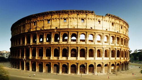
With the development of the arch, openings were created in these structures, and large structures like the colosseum in Rome were built.

The arch was first developed in Mesopotamia (modern-day Iran-Iraq-Turkey-Syria) and was then picked up by the Romans.

Load Bearing Buildings

Taj is an example of load bearing construction

In India, builders started using horizontal slabs of stone to construct floor plates. This is called trabeate construction.

The Taj is built of red sandstone masonry walls faced with white marble. Its walls are 6ft (1.8m) thick in some places.

Europeans built fine stone walled buildings with floor slabs made of wood beams and planks.

The buildings had elaborate arched openings and very finely crafted domes.

These buildings have lasted hundreds of years, with limited repair in many cases, testifying to the quality of the craftsmanship and the brilliance of the design.

Load Bearing Wall Construction

High-rise load bearing masonry construction.

And then, the Americans came in and super-sized things.

At left is the Mondadnock Tower, a 16-storey office building built in 1893 in Chicago.

It was made of brick walls 6 feet thick at the base and about 18" thick at the top. It still exists - you can rent an office space in it by clicking here.

It was built to be the world's largest office building at the time by architects Burnham & Root.

They said their design was inspired by an Egyptian pylon, which is a kind of monumental gateway to a temple, built with massive sloping masonry walls.

This is a site that explains the art and science of building construction in great clarity and detail.  Our goal is to make you understand concepts in building construction.
Written by architects and engineers, the content on the site is actually a result of accumulated years of work experience at building construction sites and design offices.  This expert knowledge of building construction is not available in textbooks!
We also take great pains to ensure that our quality of writing is of a high standard.  We aim to take complicated situations and make them simple and clear, as well as to provide content that is interesting to industry experts and newcomers alike.  Do let us know where we succeed - and where we fail - in this task.

http://www.understandconstruction.com/load-bearing-masonry-construction.html

Saturday, August 8, 2020

EARTHQUAKES - When Nature Strikes - Most people know that earthquakes occur along the San Andreas Fault of California, but few realize that there is an ever greater danger lurking under the Pacific Northwest. A tectonic plate, known as the Juan de Fuca Plate, is expected to move underneath the Pacific Northwest edge of the North American continent, creating a magnitude 9 earthquake. Like the megathrust earthquake that struck Japan in 2011, the expected earthquake could topple buildings, cause the soil to behave like a liquid, and could generate a deadly tsunami. Luckily, megathrust earthquakes are infrequent. However, no one knows when the next one will strike. At plate boundaries, such as the boundary between the Juan de Fuca Plate and the North American Plate, plates are locked together by friction. Tectonic forces act upon the plates, adding stress that will eventually overcome the friction. As a result, the plates will finally move, releasing energy in the form of earthquake waves. By studying the tectonic forces, the history of faults and the kinds of rocks involved, scientists are searching for a way to predict when earthquakes will occur and to issue warnings. John Vidale and his team at the Pacific Northwest Seismic Network is carefully monitoring ground motion and is helping the states of Washington and Oregon to protect citizens from the effects of a devastating magnitude 9 earthquake.

Convergent Plate Boundaries—Subduction Zones - Geology (U.S. ...
..............................................................................................................................................................
When Nature Strikes
THE BIG ONE: UNDERSTANDING WHY THE BIG EARTHQUAKE IS PREDICTED FOR ...
Earthquakes
.
.
Fear of Juan de Fuca megathrust earthquakeLike the megathrust earthquake that struck Japan in 2011, the expected magnitude 9 earthquake could topple buildings, cause the soil to behave like a liquid, and could generate a deadly tsunami. Tectonic forces act upon the plates, adding stress that will eventually overcome the friction. As a result, the plates will finally move, releasing energy in the form of earthquake waves - no one knows when the next one will strike
Windows to the Universe 


Most people know that earthquakes occur along the San Andreas Fault of California, but few realize that there is an ever greater danger lurking under the Pacific Northwest.
A tectonic plate, known as the Juan de Fuca Plate, is expected to move underneath the Pacific Northwest edge of the North American continent, creating a magnitude 9 earthquake.
Like the megathrust earthquake that struck Japan in 2011, the expected earthquake could topple buildings, cause the soil to behave like a liquid, and could generate a deadly tsunami.
Juan de Fuca plate is making moves | Sequim GazetteLuckily, megathrust earthquakes are infrequent. However, no one knows when the next one will strike.
At plate boundaries, such as the boundary between the Juan de Fuca Plate and the North American Plate, plates are locked together by friction.
Tectonic forces act upon the plates, adding stress that will eventually overcome the friction.
As a result, the plates will finally move, releasing energy in the form of earthquake waves.
By studying the tectonic forces, the history of faults and the kinds of rocks involved, scientists are searching for a way to predict when earthquakes will occur and to issue warnings.
John Vidale and his team at the Pacific Northwest Seismic Network is carefully monitoring ground motion and is helping the states of Washington and Oregon to protect citizens from the effects of a devastating magnitude 9 earthquake.

"When Nature Strikes" is produced by NBC Learn in partnership with the National Science Foundation.
The Windows to the Universe website is a richly interlinked ecosystem for learning about the Earth and Space sciences for use by the general public, students, and teachers. Windows to the Universe has been in development since 1995. The project started, with support from NASA for a proposal submitted by Dr. Roberta Johnson, Director of Windows to the Universe, to NASA while she was on the Research Faculty at the University of Michigan's Department of Atmospheric, Oceanic, and Space Sciences. In 2000, Dr. Johnson moved with the project to the University Corporation for Atmospheric Research (UCAR), where she continued development on the project with the Windows to the Universe team on numerous grants and contracts over the past decade. In 2010, website management and ownership moved to the National Earth Science Teachers Association, where we will be expanding opportunities to collaborate with the project - with the hope that it becomes a platform for Earth and space science education globally.
Tomography reveals buoyant asthenosphere accumulating beneath the ...

Saturday, July 6, 2019

THE GREAT CASCADIA EARTHQUAKE OF 2XXX - Cascadia is America's own tectonic version of Sumatra, where the magnitude 9.3 earthquake Stretching off the Pacific shore from northern California some 1300 kilometers to the tip of Vancouver Island, the Cascadia subduction zone appears capable of its own magnitude 9 earthquake. We've seen enough recent M 9 earthquakes to have a good idea of what the next one will do to Cascadia: they struck inhabited regions in 1960 (Chile), 1964 (Alaska), 2004 (Sumatra) and 2010 (Chile again).


................................................................................................................................
cascadia tectonic setting
The Great Cascadia
Earthquake 
of 2xxx
by Andrew Alden 


Cascadia is America's own tectonic version of Sumatra, where the magnitude 9.3 earthquake and tsunami of 2004 occurred.
Stretching off the Pacific shore from northern California some 1300 kilometers to the tip of Vancouver Island, the Cascadia subduction zone appears capable of its own magnitude 9 earthquake.
What do we know about its behavior and its history? What would that great Cascadia earthquake be like?
Subduction Zone Earthquakes, Cascadia and Elsewhere
Subduction zones are places where one lithospheric plate plunges beneath another (see "Subduction in a Nutshell").
They create three kinds of earthquakes: those within the upper plate, those within the lower plate, and those between the plates.
The first two categories can include large, damaging quakes of magnitude (M) 7, comparable to the Northridge 1994 and Kobe 1995 events.
They can damage whole cities and counties. But the third category is what concerns disaster officials.
These great subduction events, M 8 and M 9, can release hundreds of times more energy and damage wide regions inhabited by millions of people. They are what everybody means by "the Big One."
Earthquakes get their energy from strain (distortion) built up in rocks from the stress forces along a fault (see "Earthquakes in a Nutshell").
Great subduction events are so large because the fault involved has a very large surface area on which rocks gather strain.
Knowing this, we can easily find where the world's M 9 earthquakes happen by locating the longest subduction zones: southern Mexico and Central America, South America's Pacific coast, Iran and the Himalaya, western Indonesia, eastern Asia from New Guinea to Kamchatka, the Tonga Trench, the Aleutian Island chain and Alaska Peninsula, and Cascadia.
Magnitude-9 quakes differ from smaller ones in two distinct ways: they last longer and they have more low-frequency energy.
They don't shake any harder, but the greater length of shaking causes more destruction. And the low frequencies are more effective at causing landslides, damaging large structures and exciting water bodies.
Their power to move water accounts for the fearsome threat of tsunamis, both in the shaken region and on coastlines near and far (see more on tsunamis).
After the strain energy is released in great earthquakes, whole coastlines may subside as the crust relaxes.
Offshore, the ocean floor may rise. Volcanoes may respond with their own activity.
Low-lying lands may turn to mush from seismic liquefaction and widespread landslides may be triggered, sometimes creeping along for years afterward. These things may leave clues for future geologists.
Cascadia's Earthquake History
Studies of past subduction earthquakes are inexact things, based on finding their geologic signs: sudden changes of elevation that drown coastal forests, disturbances in ancient tree rings, buried beds of beach sand washed far inland and so on.
Twenty-five years of research has determined that Big Ones affect Cascadia, or large parts of it, every few centuries. Times between events range from 200 to about 1000 years, and the average is around 500 years.
The most recent Big One is rather well dated, although no one in Cascadia at the time could write.
It occurred around 9 p.m. on 26 January 1700. We know this because the tsunami it generated struck the shores of Japan the next day, where the authorities recorded the signs and damages.
In Cascadia, tree rings, oral traditions of the local people and geologic evidence support this story.
The Coming Big One
We've seen enough recent M 9 earthquakes to have a good idea of what the next one will do to Cascadia: they struck inhabited regions in 1960 (Chile), 1964 (Alaska), 2004 (Sumatra) and 2010 (Chile again).
The Cascadia Region Earthquake Workgroup (CREW) recently prepared a 24-page booklet, including photos from historic quakes, to bring the dreadful scenario to life:
·          Strong shaking will last for 4 minutes, killing and injuring thousands.
·          A tsunami up to 10 meters high will wash over the coast within minutes.
·          Much of coastal Route 101 will be impassable due to wave and landslide damage.
·          Parts of the coast will be cut off from inland cities when the roads are buried. Roads through the Cascades may likewise be blocked.
·          For rescue, first aid, and immediate relief most places will be on their own.
·          Utilities and transportation in the I-5/Highway 99 corridor will be disrupted for months.
·          Cities may have "significant fatalities" as tall buildings collapse.
·         Aftershocks will continue for years, some of them large earthquakes in themselves.
From Seattle on down, Cascadian governments are preparing for this event. (In this effort they have much to learn from Japan's Tokai Earthquake program.)
The work ahead is enormous and will never be finished, but all of it will count: public education, setting up tsunami evacuation routes, strengthening buildings and building codes, conducting drills and more.

Andrew Alden
Professional geologist, writer, photographer, and geological tour guide
Thirty-seven years of experience writing about geological subjects
Six years as a research guide with U.S. Geological Survey (USGS)
Experience
Andrew Alden is a former writer for ThoughtCo who contributed hundreds of articles for more than 17 years. Andrew works as a geologist, writer, editor, and photographer. He has written on geological subjects since 1981 and participates actively in his field. For example, Andrew spent six years as a research guide with the U.S. Geological Survey, leading excursions on both land land and at sea. And since 1992, he has hosted the earthquakes conference for the online discussion platform, The Well, which began as a dialogue between the writers and readers of the Whole Earth Review. 
In addition, Andrew is a longtime member of the member of the Geological Society of America — an international society that serves members in academia, government, and industry; and the American Geophysical Union — a community of earth and space scientists that advances the power of science to ensure a sustainable future.
Andrew lives in Oakland, California; and though he writes about the whole planet and beyond, Andrew finds his own city full of interest too and blogs about its geology. 
Education
Andrew Alden holds a bachelor's (B.A.) degree in Earth Science from the University of New Hampshire, College of Engineering and Physical Sciences, in Durham, N.H.
Awards and Publications
Andrew Alden on Earthquakes ​(The Well Group, Inc., 2011)
Assessment of River — Floodplain Aquifer Interactions (Environmental and Engineering Geoscience, 1997)
Andrew Alden on Hosting (The Well Group, Inc., 1995)
ThoughtCo and Dotdash
ThoughtCo is a premier reference site focusing on expert-created education content. We are one of the top-10 information sites in the world as rated by comScore, a leading Internet measurement company. Every month, more than 13 million readers seek answers to their questions on ThoughtCo.
For more than 20 years, Dotdash brands have been helping people find answers, solve problems, and get inspired. We are one of the top-20 largest content publishers on the Internet according to comScore, and reach more than 30% of the U.S. population monthly. Our brands collectively have won more than 20 industry awards in the last year alone, and recently Dotdash was named Publisher of the Year by Digiday, a leading industry publication.

Friday, July 5, 2019

WHAT IS SUBDUCTION? - True subduction happens only to oceanic lithosphere. When oceanic lithosphere meets continental lithosphere, the continent always stays on top while the oceanic plate subducts. When two oceanic plates meet, the older plate subducts. Once a plate begins to subduct, gravity takes over. Subduction, in the form of gravitational "slab pull," is thought to be the largest force driving plate tectonics. Where the subducting slab bends downward, a deep-sea trench forms. The deepest of these is the Mariana Trench, at over 36,000 feet below sea level. Subduction also forms some of Earth's most powerful earthquakes.

An illustration of subduction zones
...............................................................................................................................
What Is Subduction?
by Andrew Alden


Subduction, Latin for "carried under," is a term used for a specific type of plate interaction.
It happens when one lithospheric plate meets another — that is, in convergent zones — and the denser plate sinks down into the mantle.
How Subduction Happens
Continents are made up of rocks that are too buoyant to be carried much farther than about 100 kilometers deep.
So when a continent meets a continent, no subduction occurs (instead, the plates collide and thicken). True subduction happens only to oceanic lithosphere.
When oceanic lithosphere meets continental lithosphere, the continent always stays on top while the oceanic plate subducts. When two oceanic plates meet, the older plate subducts. 
Oceanic lithosphere is formed hot and thin at mid-ocean ridges and grows thick as more rock hardens underneath it.
As it moves away from the ridge, it cools. Rocks shrink as they cool, so the plate becomes more dense and sits lower than younger, hotter plates.
Therefore, when two plates meet, the younger, higher plate has an edge and does not sink.
Oceanic plates do not float on the asthenosphere like ice on water — they are more like sheets of paper on water, ready to sink as soon as one edge can start the process. They are gravitationally unstable.
Once a plate begins to subduct, gravity takes over. A descending plate is usually referred to as a "slab."
Where very old seafloor is being subducted, the slab falls almost straight down, and where younger plates are being subducted, the slab descends at a shallow angle.
Subduction, in the form of gravitational "slab pull," is thought to be the largest force driving plate tectonics.
At a certain depth, the high pressure turns the basalt in the slab to a denser rock, eclogite (that is, a feldspar-pyroxene mixture becomes garnet-pyroxene). This makes the slab even more eager to descend.
It's a mistake to picture subduction as a sumo match, a battle of plates in which the top plate forces the lower one down.
In many cases it's more like jiu-jitsu: the lower plate is actively sinking as the bend along its front edge works backward (slab rollback), so that the upper plate is actually sucked over the lower plate.
This explains why there are often zones of stretching, or crustal extension, in the upper plate at subduction zones.
Ocean Trenches and Accretionary Wedges
Where the subducting slab bends downward, a deep-sea trench forms. The deepest of these is the Mariana Trench, at over 36,000 feet below sea level.
Trenches capture a lot of sediment from nearby land masses, much of which is carried down along with the slab.
In about half the world's trenches, some of that sediment is instead scraped off. It remains on top as a wedge of material, known as an accretionary wedge or prism, like snow in front of a plow.
Slowly, the trench is pushed offshore as the upper plate grows. ​
Volcanoes, Earthquakes and the Pacific Ring of Fire
Once subduction begins, the materials on top of the slab — sediments, water, and delicate minerals — are carried down with it.
The water, thick with dissolved minerals, rises into the upper plate. There, this chemically active fluid enters an energetic cycle of volcanism and tectonic activity. 
This process forms arc volcanism and is sometimes known as the subduction factory. The rest of the slab keeps descending and leaves the realm of plate tectonics. 
Subduction also forms some of Earth's most powerful earthquakes.
Slabs normally subduct at a rate of a few centimeters per year, but sometimes the crust may stick and cause strain. This stores potential energy, which releases itself as an earthquake whenever the weakest point along the fault ruptures.
Subduction earthquakes can be very powerful, as the faults they occur along have a very large surface area to accumulate strain.
The Cascadia Subduction Zone off the coast of northwest North America, for example, is over 600 miles long. A magnitude ~9 earthquake occurred along this zone in 1700 AD, and seismologists think the area may see another one soon. 
Subduction-caused volcanism and earthquake activity occur frequently along the outer edges of the Pacific Ocean in an area known as the Pacific Ring of Fire.
In fact, this area has seen the eight most powerful earthquakes ever recorded and is home to over 75 percent of the world's active and dormant volcanoes. 

Edited by Brooks Mitchell
Andrew Alden
Professional geologist, writer, photographer, and geological tour guide
Thirty-seven years of experience writing about geological subjects
Six years as a research guide with U.S. Geological Survey (USGS)
Experience
Andrew Alden is a former writer for ThoughtCo who contributed hundreds of articles for more than 17 years. Andrew works as a geologist, writer, editor, and photographer. He has written on geological subjects since 1981 and participates actively in his field. For example, Andrew spent six years as a research guide with the U.S. Geological Survey, leading excursions on both land land and at sea. And since 1992, he has hosted the earthquakes conference for the online discussion platform, The Well, which began as a dialogue between the writers and readers of the Whole Earth Review. 
In addition, Andrew is a longtime member of the member of the Geological Society of America — an international society that serves members in academia, government, and industry; and the American Geophysical Union — a community of earth and space scientists that advances the power of science to ensure a sustainable future.
Andrew lives in Oakland, California; and though he writes about the whole planet and beyond, Andrew finds his own city full of interest too and blogs about its geology. 
Education
Andrew Alden holds a bachelor's (B.A.) degree in Earth Science from the University of New Hampshire, College of Engineering and Physical Sciences, in Durham, N.H.
Awards and Publications
Andrew Alden on Earthquakes ​(The Well Group, Inc., 2011)
Assessment of River — Floodplain Aquifer Interactions (Environmental and Engineering Geoscience, 1997)
Andrew Alden on Hosting (The Well Group, Inc., 1995)
ThoughtCo and Dotdash
ThoughtCo is a premier reference site focusing on expert-created education content. We are one of the top-10 information sites in the world as rated by comScore, a leading Internet measurement company. Every month, more than 13 million readers seek answers to their questions on ThoughtCo.
For more than 20 years, Dotdash brands have been helping people find answers, solve problems, and get inspired. We are one of the top-20 largest content publishers on the Internet according to comScore, and reach more than 30% of the U.S. population monthly. Our brands collectively have won more than 20 industry awards in the last year alone, and recently Dotdash was named Publisher of the Year by Digiday, a leading industry publication.

An illustration of subduction zones