
..........................................................................................................................................................
 Taal Volcano Eruption
Huge Philippines volcano eruption
blasts ash 9 miles up as satellites watch
By Samantha Mathewson
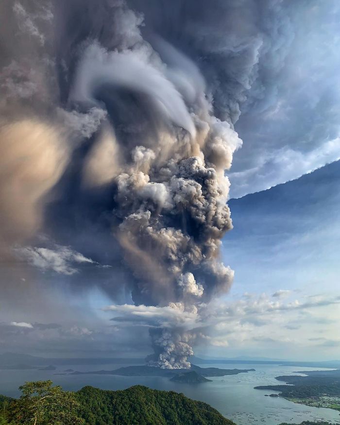
The Taal volcano eruption in the Philippines this week
sent ash plumes 9 miles (14 kilometers) into the air, new satellite imagery
shows.
Located on Luzon Island, the Taal volcano began to
erupt around 5:30 p.m. local time on Sunday, Jan. 12 (4:30 a.m. EST, 0930 GMT),
according to a statement from the National Oceanic and Atmospheric
Administration (NOAA).
 Satellites operated by Japan, NASA and the NOAA
captured views of the volcano from space, revealing the widespread ash and
smoke that spread across the island and surrounding areas in the aftermath of
the eruption.
Satellites operated by Japan, NASA and the NOAA
captured views of the volcano from space, revealing the widespread ash and
smoke that spread across the island and surrounding areas in the aftermath of
the eruption.
"On Jan. 12, 2020, the
Himawari-8 satellite captured an image of the Philippines during the aftermath
of Taal Volcano's first volcanic eruption in over forty years," NOAA officials wrote in a statement.
"Eruptive activity, which has
been occurring since 5:30 p.m. local time on Jan. 12, has generated steam-laden
plumes up to nine miles tall, causing travel disruptions and extreme weather
events in and around the vicinity of its location in Volcano Island, south of
the archipelago’s capital city of Manila."
Clouds of ash have spread more than 62 miles (100
kilometers) north, reaching the capital city of Manila.
The Joint Polar Satellite System (JPSS) also captured
views of the volcano's eruption — which was the first since 1977.
The Taal Volcano is considered the second most active
in the Philippines, according to the NOAA.
 The NOAA-20 satellite provided an infrared view of the
eruption, while the Ozone Mapping and Profiler Suite (OMPS) instrument on the
Suomi National Polar-orbiting Partnership (Suomi NPP) satellite captured traces
of sulfur dioxide from the volcano.
The NOAA-20 satellite provided an infrared view of the
eruption, while the Ozone Mapping and Profiler Suite (OMPS) instrument on the
Suomi National Polar-orbiting Partnership (Suomi NPP) satellite captured traces
of sulfur dioxide from the volcano.
The JPSS Program shared a side-by-side view of the two
images on Twitter.
The Taal volcano in the Philippines sends an ash cloud
9 miles up into the atmosphere in this image from Jan. 12, 2020 captured by the
Himawari-8 Earth observation satellite.
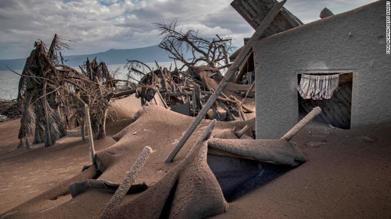
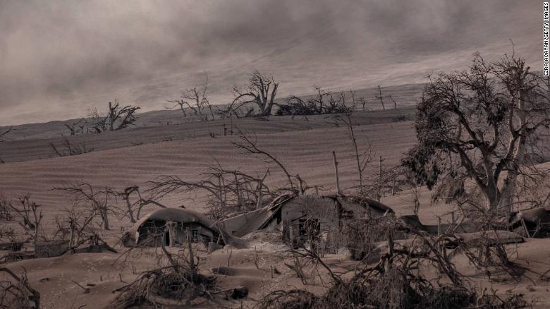
In the wake of the eruption, all residents within a
nine-mile radius have been ordered to evacuate the area due to the high risk
for subsequent eruptions, reduced visibility and health concerns, such as
irritation and breathing problems.
Intermittent rainfall is also expected in the area,
which may trigger flash flooding or landslides, NOAA officials have said.
Follow Samantha Mathewson @Sam_Ashley13.
Follow us on Twitter @Spacedotcom and on Facebook.
No comments:
Post a Comment