

Weather Systems And Jet Streams
The Jet Stream: What It Is and How It Affects Our Weather
by Tiffany Means
You've probably heard the
words "jet stream" many times while watching weather forecasts on TV.
That's because the jet stream
and its location is key to forecasting where weather systems will travel.
Without it, there would be
nothing to help "steer" our daily weather from location to location.
Rivers of Rapidly Moving Air
Named
for their similarity to fast moving jets of water, jet streams are bands of
strong winds in the upper levels of the atmosphere.
Jet
streams form at the boundaries of contrasting air masses.
When
warm and cold air meet, the difference in their air pressures as a result of
their temperature differences (recall that warm air is less dense, and cold
air, more dense) causes air to flow from higher pressure (the warm air mass) to
lower pressure (the cold air mass), thereby creating high winds.
Because
the differences in temperature, and therefore, pressure, are very large, so too
is the strength of the resulting winds.
Jet Stream Location, Speed, Direction
Jet
streams "live" at the tropopause (about 6 to 9 miles
off the ground) and are several thousand miles long.
Jet stream winds range in
speed from 120 to 250 mph, but can reach more than 275 mph.
Oftentimes, the jet houses
pockets of winds that move faster than the surrounding jet stream winds.
These "jet streaks"
play an important role in precipitation and storm formation.
(If a
jet streak is visually divided into fourths, like a pie, its left front and
right rear quadrants are the most favorable for precipitation and storm
development. If a weak low pressure area passes through either of these
locations, it will quickly strengthen into a dangerous storm.)
Jet winds blow from west
to east, but also meander north to south in a wave-shaped pattern.
These
waves and large ripples (known as planetary, or Rossby waves) form
U-shaped troughs of
low pressure that allow cold air to spill southwards, and upside-down
U-shaped ridges of
high pressure that bring warm air northwards.
Discovered by Weather Balloons
One
of the first names associated with the jet stream is Wasaburo Oishi.
A Japanese meteorologist,
Oishi discovered the jet stream in the 1920s while using weather balloons to
track upper level winds near Mount Fuji.
However, his work went
unnoticed outside of Japan.
In 1933, knowledge of the jet
stream increased when American aviator Wiley Post began exploring
long-distance, high-altitude flight.
Despite these discoveries,
the term "jet stream" was not coined until 1939 by German
meteorologist Heinrich Seilkopf.
Meet the Polar and Subtropical Jets
While
we typically talk about the jet stream as if there was only one, there are
actually two: a polar jet stream and a subtropical jet stream.
The Northern Hemisphere and
the Southern Hemisphere each have both a polar and a subtropical branch of the
jet.
·
The Polar Jet: In
North America, the polar jet is more commonly known as "the jet" or
the "mid-latitude jet" (so-called because it occurs over the
mid-latitudes).
·
The Subtropical Jet: The
subtropical jet is named for its existence at 30°N and 30°S latitude—a climate
zone known as the subtropics. It forms at the boundary temperature difference between
air at mid-latitudes and warmer air near the equator. Unlike the polar jet, the
subtropical jet is only present in the wintertime—the only time of year when
temperature contrasts in the subtropics are strong enough to form jet winds.
The subtropical jet is
generally weaker than the polar jet. It is most pronounced over the western
Pacific.
Jet Position Changes With the Seasons
Jet
streams change position, location, and strength depending on the season.
In the winter, areas in the
Northern Hemisphere may get colder than normal periods as the jet stream dips
"lower" bringing cold air in from the polar regions.
Although
the height of the jet stream is typically 20,000 feet or more, the influences
on weather patterns can be substantial as well.
High
wind speeds can drive and direct storms creating devastating droughts and
floods. A shift in the jet stream is a suspect in the causes of the Dust Bowl.
In spring, the polar jet
starts to journey north from its winter position along the lower third of the
U.S., back to its "permanent" home at 50-60°N latitude (over Canada).
As the jet gradually lifts
northward, highs and lows are "steered" along its path and across the
regions where it's currently positioned.
Why does the jet stream move?
Well, jet streams "follow" the Sun, Earth's primary source of heat
energy.
Recall that in spring in the
Northern Hemisphere, the Sun's vertical rays go from striking the Tropic of
Capricorn (23.5° south latitude) to striking more northerly latitudes (until it
reaches the Tropic of Cancer, 23.5° north latitude, on the summer solstice).
As these northerly latitudes
warm, the jet stream, which occurs near boundaries of cold and warm air masses,
must also shift northward to remain at the opposing edge of warm and cool air.
Locating Jets on Weather Maps
On
surface maps: Many news and media that broadcast weather forecasts show
the jet stream as a moving band of arrows across the U.S., but the jet
stream isn't a standard feature of surface analysis maps.
Here's an easy way to eyeball
the jet position: since it steers high and low pressure systems, simply note
where these are located and draw a continuous curved line in-between them,
taking care to arch your line over highs and
underneath lows.
On upper level maps: The
jet stream "lives" at heights of 30,000 to 40,000 feet above Earth's
surface. At these altitudes, atmospheric pressure equals around 200 to 300 mb;
this is why the 200 and 300 mb level upper air charts are typically used for
jet stream forecasting.
When looking at other upper
level maps, the jet position can be guessed by noting where pressure or wind
contours are spaced close together.
Tiffany Means is a meteorologist, science writer,
and avid cloud watcher/photographer.
Experience
Tiffany has been finding beauty skyward and
sharing it with others since the age of 5. By twelve, she knew she wanted to
pursue weather professionally—thanks in part to the release of the blockbuster
film Twister. Since those days, Tiffany has interned with the domestic and
international weather departments at CNN, written monthly climate reports for
NOAA’s National Centers for Environmental
Prediction, and participated in a number of science outreach events (such as
the Science Olympiad Competition). She has personally experienced such
weather greats as the Blizzard of 1993, and the floods of Hurricane
Francis (2004) and Ivan (2004).
Education
Tiffany holds a bachelor’s degree in Atmospheric
Science with a concentration in weather forecasting from the University of
North Carolina at Asheville.
Tiffany is a proud member of the American Meteorological Society (AMS).
Tiffany Means
"Weather affects us all. We check it on a
daily basis, and talk about it with complete strangers...but
it is so much more than 5-day forecasts and small talk! Through my
enthusiasm for and expertise in the weather sciences, I hope to spark your
curiosity about our atmosphere, create an awareness that will keep you weather
ready and safe, and strengthen your environmental responsibility to our
atmosphere, water, and earth."
Contact Tiffany: Tiffany can be reached at aboutweatherexpert@gmail.com with questions,
comments, reprint requests, or suggestions. You can also connect with her via
the social links below.
https://www.thoughtco.com/jet-stream-and-weather-3444495

 |
| Multi-Media Filter, Highly-Activated Carbon Filter, Zeolite-Process Water Softener With Brine Tank, Fiberglass Ballast-Type Pressure Tank (fully automatic backwash & regeneration) |
.
PURICARE
Treatment
Systems
.
...
Aganan, Pavia, Iloilo, Philippines
Aganan, Pavia, Iloilo, Philippines
...
CLICK HERE . . . to view company profile . . .
CLICK HERE . . . to view company profile . . .
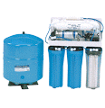 | ||
| Reverse Osmosis with Steel Tank & Cartridge Pre-Filters
|


 |
| Tachmina Solenoid-Driven Chemical Metering Pump - ensures regulated dosing of chlorine into water system without human intervention |

No comments:
Post a Comment